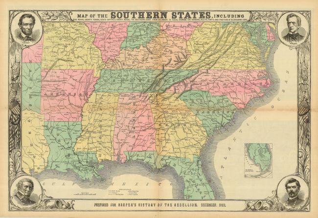
Subject: Southern United States -
Period: 1863 (dated)
Publication: Harper's History of the Great Rebellion
Color: Hand Color
Size:
30 x 20 inches
76.2 x 50.8 cm
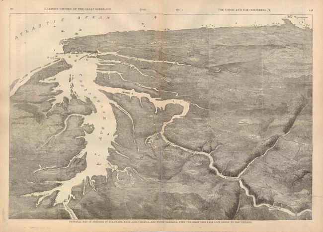
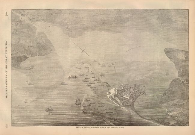
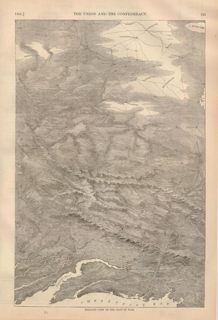
This terrific Civil War map shows good detail of the towns, villages, railroads, and ship blockade of the south. The title continues along the bottom: "Prepared for Harper's History of the Rebellion. December, 1863." Surrounded by a very decorative border that features portraits at each corner of Lincoln, Seward, Gen. Scott, and Gen. McClellan. With an inset of "Florida. Southern Part." at lower right. On the verso are three black and white wood engraved birds-eye views, two single page and a large double page. The double page view details the region around the Chesapeake Bay and is titled "Pictorial Map of Portions of Delaware, Maryland, Virginia, and North Carolina…" The other two are "Balloon View of Fortress Monroe and Hampton Roads" and "Balloon View of the Seat of War."
References: Stephenson, R.W. (CW) 14.55, 32.9, 37.
Condition: C+
Folding, as issued. This example has terrific original coloring, full margins and a dark impression. One fold has some toning with two splits, a few other intersection fold splits, and some marginal tears or chipping, all closed on verso with archival tape. Printed on fragile newsprint, it will benefit from professional attention. Shows much better than the condition suggests.