Subject: Colonial Chesapeake Bay
Period: 1649 (circa)
Publication:
Color: Hand Color
Size:
19.4 x 15 inches
49.3 x 38.1 cm
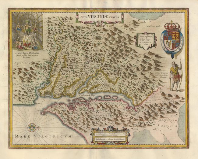
This graphic map is Henricus Hondius' version of Capt. John Smith's important map of 1612, drawn from his brother's earlier map of 1618. After the death of Jodocus Hondius in 1629, his widow sold a number of plates to Blaeu. Angry at the sale to a competitor, Henricus and Joannes Jansson engaged engravers to cut new plates, which were largely based on Jodocus' work. In the upper left corner is an engraving of the great Indian chief Powhatan seated on his throne and surrounded by his subjects. A Susquehanna chief, facing in toward Chesapeake Bay, is depicted on the right under a coat of arms. First state, with German text on verso.
References: Burden #228.
Condition: A
Very good impression with a professionally repaired centerfold separation.