Subject: Eastern United States
Period: 1849 (dated)
Publication:
Color: Hand Color
Size:
47.5 x 38 inches
120.7 x 96.5 cm
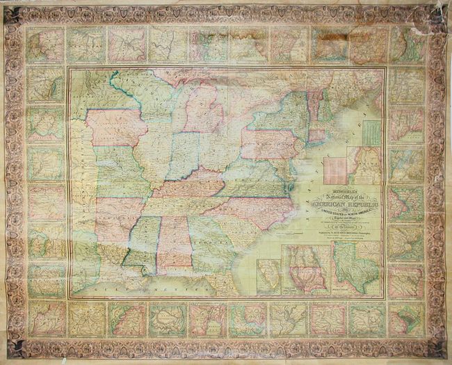
This is a beautiful and well engraved wall map that was drawn by J.H. Young and engraved by J.H. Brightly. This remarkable map extends into Texas, Indian Territory, and Minnesota which contains Dakota. Large insets within the map area include the State of Texas (shown with its largest extent) and another of Oregon and Upper California. The map is very detailed with hundreds of place names, plus roads, villages, railroads, ports, etc. A table gives the 1840 population of 120 cities and another gives the state's population of Whites, Free Blacks and Slaves. New Hampshire is listed with only one slave. All surrounded by a wide decorative border, which surrounds another border composed of detailed plans of 32 important cities. An exceptional map whose surface is in remarkable original condition. This large edition should not be confused with the smaller (24 x 34"), and more common, map of the same title.
References:
Condition: B+
A nice example with clear varnish that has not darkened as normally seen. Piping frayed or missing along edges, light water stain in upper portion affecting city vignettes, and a little cracking at upper right corner. One roller present, detached.