Subject: Eastern United States
Period: 1804 (dated)
Publication:
Color: Hand Color
Size:
26 x 21 inches
66 x 53.3 cm
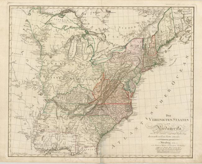
Extremely rare German map of the United States based on Arrowsmith and Lewis's maps of 1795 and 1796. The map notes in the title that it is for Ebelings Beschreibung, however this map is not noted in Ristow as a part of the rare Ebeling-Sotzmann series of 10 maps that were made for the Atlas von Nordamerika , so this was probably separately issued as was the nearly identical 1799 map referenced in McCorkle without the addition of Sotzmann's name. The map is filled with detail, the new Tennasee Gouvernment is shown and Georgia is portrayed with a large and unusual configuration due to the Spanish claims on the West Florida region. The northwest portion shown here extends from the Ohio River to the Mississippi up to Canada and is shown as Native American territory, while the future Minnesota is beset by a region called Mosquito Land Shaft.
References: cf McCorkle #799.11; Ristow pp. 169-178.
Condition: B
Original color on a sheet of strong paper. Couple of faint stains and some mildew in the bottom margin just entering the map. Still a nice example for such a rare map.