Subject: Eastern United States
Period: 1788 (published)
Publication: Le Grand Vaugondy
Color: Hand Color
Size:
24 x 19 inches
61 x 48.3 cm
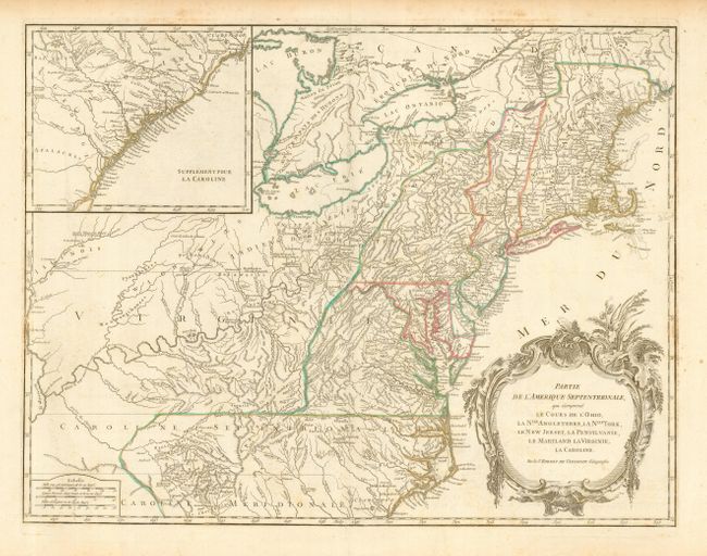
Beautifully engraved, large map of the eastern seaboard with an inset of the South Carolina coast on the same scale. The map is apparently based on the seminal map by Mitchell, published in 1755, the same year this plate was initially engraved. The mapping of the trans-Allegheny and Great Lakes regions and in the interior of New England is of particular interest, for this shows some of the earliest accurate information of these regions incorporating data from the Mitchell, Evans and Fry-Jefferson maps. This is a later state with the final line below the title "Avec Privilege 1755" removed. The large inset at upper left continues the main map from Cape Fear south through the Carolinas and Georgia to F. St. Georges. Impressive title cartouche fills the Atlantic.
References: Cumming (SE) #295; McCorkle #755-37; Pedley #469; Sellers & Van Ee #718.
Condition: B+
Very fine impression and coloring on a thick sheet of hand laid paper with large watermarks including the date of 1788. With wide, original margins. Apart from a little light scattered foxing the map is very good to fine.