Subject: United States
Period: 1857 (circa)
Publication: General Atlas
Color: Hand Color
Size:
25 x 14.5 inches
63.5 x 36.8 cm
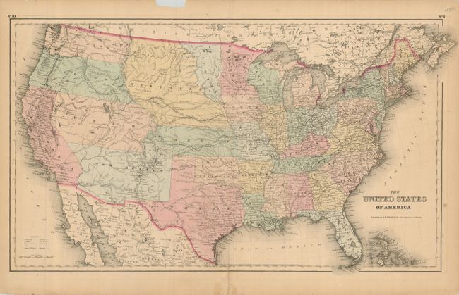
This great map of the United States portrays early western territorial boundaries. Minnesota now has its correct state boundary with the newly formed Dacotah Territory wedged between it and the huge Nebraska region that extends to the Continental Divide at the Rocky Mountains. The large Kanzas Territory borders Utah and New Mexico in the west as there is no Colorado. Washington and Oregon both extend eastward to the Rocky Mountains and the Continental Divide. Utah and New Mexico are both shown in their largest configurations. The sheet is filled with details and place names, forts, Indian Tribes, emigrant roads and much more. Several exploratory routes are shown, including those of Fremont, Marcy, and Kearney. Dated 1855, published in 1857.
References:
Condition: B
Nice original coloring. The map has a few marginal chips and some repairs to several edge tears, one entering the image 1" at lower right. The top centerfold is separated just into the map. It would frame quite well.