Subject: United States
Period: 1856 (published)
Publication: Senate Ex. Doc. No. 77
Color: Hand Color
Size:
48.1 x 31.25 inches
122.2 x 79.4 cm
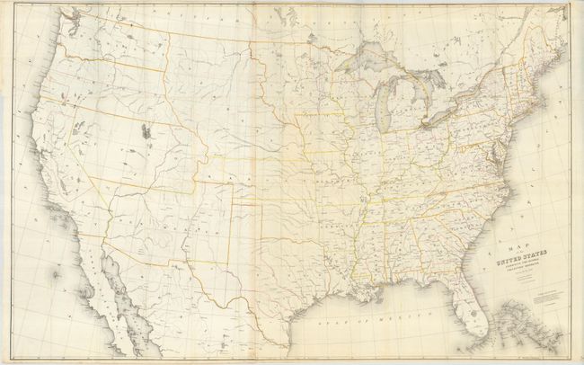
A relatively scarce and most interesting map that has red overprinted lines indicating the district boundaries and yellow ones distinguishing the states and territories. Today's Arizona is part of the large New Mexico Territory, Nebraska includes the present states of the Dakotas and Wyoming, West Virginia has not separated from Virginia, Utah spans from California to Kansas, and Washington and Oregon extend to the Continental Divide. The Indian Territory is unnamed. Burr was 'Geographer and Draftsman to the Senate' between 1855-59. On two joined sheets, as issued.
References:
Condition: A
Folding as issued. A near fine example with just one small stain at bottom near a fold line. Issued folding, now pressed and backed with archival tissue.