Subject: Eastern United States & Canada
Period: 1845 (dated)
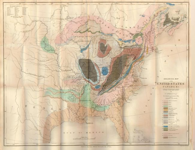
Publication: Travels in North American in the Years 1841-2; with Geological Observations…
Color: Hand Color
Size:
19.8 x 15.3 inches
50.3 x 38.9 cm
This is an important and early geological map by Sir Charles Lyell. Color coded key identifies 20 different geological formations. The map extends to about the 110th meridian to include the Republic of Texas, Arkansas, Missouri and the North West Territory shown west of the Mississippi River. Lyell had two major and controversial goals in publishing his work and this map: First, he endeavored to establish a strict uniformitarian theory of the earth's geology, and to standardize the terminology and methodology employed in the science of geology. His map is, along with James Hall's work of 1843, a landmark improvement in geological representations and mapping.
References: Marcou and Marcou #34.
Condition: B
Very fine impression with original coloring on thick paper. Binding trim as left with 2" tear into blank area, close on verso. Trace of foxing or offsetting in lower blank area of map.