Subject: United States & Canada
Period: 1832-3 (dated)
Publication:
Color: Hand Color
The following maps are all finely engraved and feature the terrific detail for which the society's maps are renowned. They are filled with place names and much information on the villages, court houses and roads of the day, plus good topographical and watershed detail. The maps each have a keyboard style border and were published by Baldwin and Cradock. The lot includes the following:
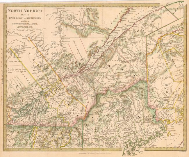
1) North America Sheet II Lower-Canada and New Brunswick. (15.3 x 13") 1832. The map includes the region from about St. John west to include all of Lower Canada.
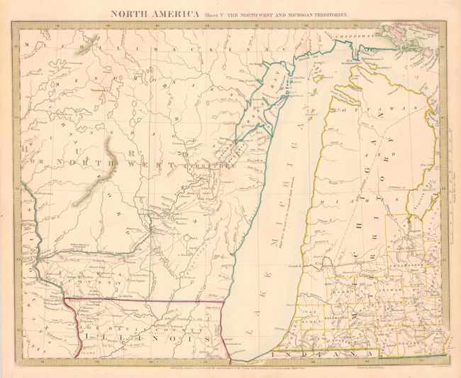
2) North America Sheet V The Northwest and Michigan Territories. (15 x 12") 1833. Map features an elongated Lake Michigan and bears some resemblance to Burr's map of 1831. The Ottawa and Miami Indian nations are shown occupying the whole northern part of Michigan and the only settlement in the North West Territory is Green Bay Township along with Fort Howard.
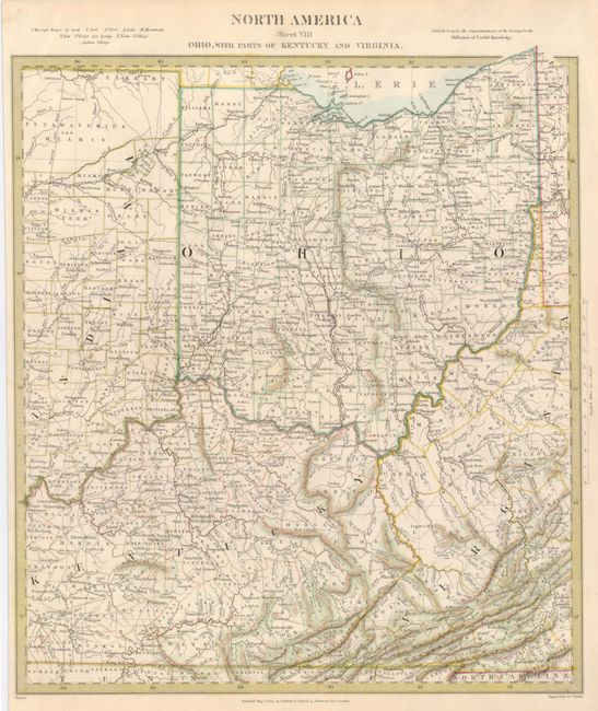
3) North America Sheet VIII. Ohio, with parts of Kentucky and Virginia. (12.3 x 14") 1833. The National Road between Springfield, Ohio and Indianapolis is clearly shown. Scope extends east just to Pennsylvania and south just into Tennessee. The northern part of Indiana is nearly blank and labeled Putawatomies and Miamis.
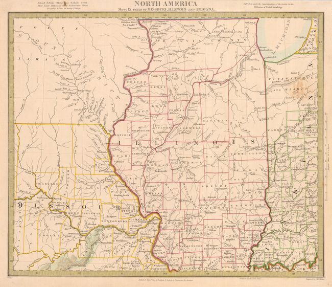
4) North America Sheet IX with parts of Missouri, Illinois and Indiana. (14.5 x 12.1") 1833. Map covers the region from present-day Iowa, here shown as Sioux District, through northwestern Indiana (lands of the Putawatomies and Miamis) in the north, and from the Osage River to the Kentucky/Indiana boundary in the south. Large sections have no settlement and others have early county configurations. Great map shows the extent of western emigration at this early point in U.S. history.
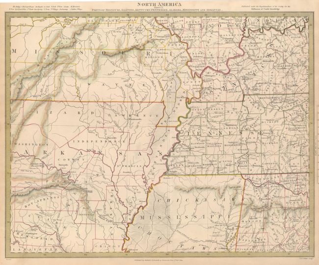
5) North America Sheet X. Parts of Missouri, Illinois, Kentucky, Tennessee, Alabama, Mississippi and Arkansas. (15.75 x 12.5") 1833. This detailed map includes the Mississippi River and Ohio River valley and extends from the Osage River in Missouri to Rome, Indiana in the north and from the Red River in Arkansas to Elyton, Alabama in the south. Large parts are marked as Indian territory. The extent of western emigration at this early point in U.S. history is shown.
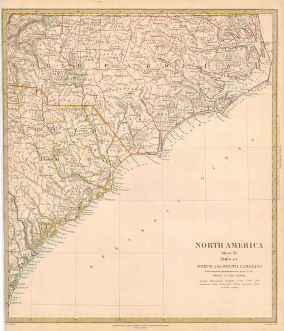
6) North America Sheet XI Parts of North and South Carolina. (13 x 15") 1833. Area includes all of the coastal regions and westward to Morgantown in North Carolina, and beyond Columbia and Unionville in South Carolina.
References:
Condition: A
Sheet XI with a close left margin. Original hand coloring.