Subject: Western Canada
Period: 1865 (circa)
Publication: Fullarton's Royal Illustrated Atlas
Color: Hand Color
Size:
21.2 x 16.6 inches
53.8 x 42.2 cm
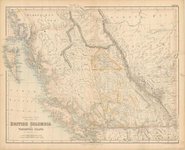
This is an early and attractive map of western Canada from 114° longitude to the Pacific Ocean. The map includes Graham and Vancouver Islands and extends to show Russian America to above the D. of York Isle. A large portion of the map is Hudson Bay Territory (dissolved in 1870), shown occupying the region east of the Rocky Mountain and north of the Simpson or Babine River. Excellent detail throughout British Columbia locates mountains and watershed, many towns and villages, roads and trails, Indian Tribes, and more. The gold regions along the Fraser River are outlined in yellow and the "Cariboo Diggings" are named near New Caledonia. A finely engraved map drawn and engraved by J. Bartholomew. This uncommon and early map is filled with exquisite detail.
References:
Condition: A
Some marginal flaws including a little soiling and two short tears closed on verso.