Catalog Archive
Auction 120, Lot 125

"A Plan of the City & Fortifications of Louisburg… [on sheet with] A Plan of the City and Harbour of Louisburg…", Gridley, Richard (Lt. Col.)

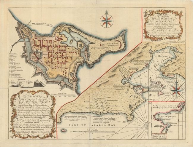
Subject: Canada, Louisbourg, Cape Breton

Period: 1758 (published)

Publication: Universal Magazine

Color: Hand Color

Size:
14.4 x 10.8 inches
36.6 x 27.4 cm
Download High Resolution Image
(or just click on image to launch the Zoom viewer)

Handsome map covering the vicinity of Louisburg during the French and Indian War with two maps on the sheet. First is a bird's-eye plan of the fortified city showing the batteries, lighthouse, military quarters, etc. The second is a plan of the vicinity with an inset of Gabarus Bay. Both include large compass roses and delicately engraved title cartouches that include brief descriptions of the battles fought in 1745.

References: Jolly UNIV-66; Kershaw #912.

Condition: B

Issued folded, now pressed. Attractive later color. Backed with Japanese tissue to repair a tear from margin into the map about 4.5".

Estimate: $250 - $300

Sold for: $250

Closed on 7/18/2007

Archived