Subject: Western North America
Period: 1798 (dated)
Publication:
Color: Black & White
Size:
19.5 x 15 inches
49.5 x 38.1 cm
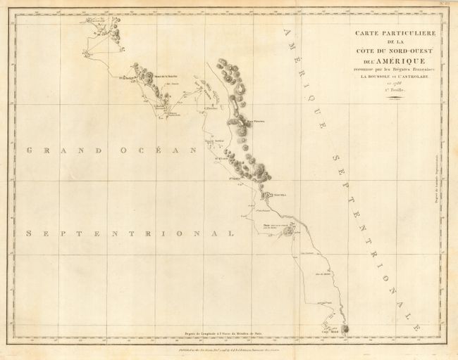
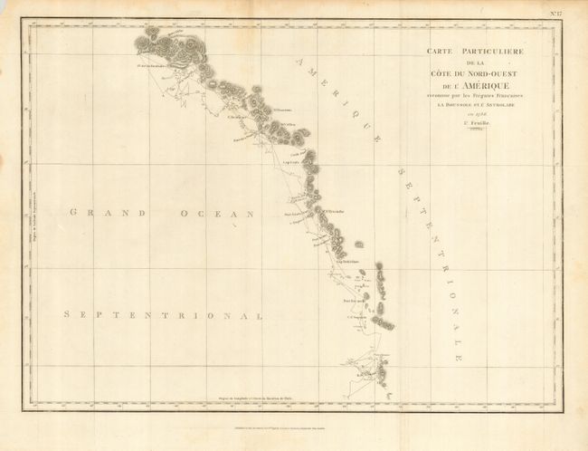
Jean-Francois de Galoup, Comte de La Perouse commanded a French scientific expedition to the Pacific in 1785-88. Recognized as one the foremost naval commanders and navigators in France, he was selected by King Louis XVI to complete Captain James Cook's exploration of the western Pacific. The British Admiralty provided scientific equipment to measure variations in magnetic compass readings and with the latest instruments for determining longitude. La Perouse explored the coasts of the Gulf of Alaska and northwestern North America in search of the fabled Northwest Passage. After leaving America his expedition continued on to Asia where he explored from Macao to Kamchatka and the Solomon Islands in the South Pacific. La Perouse was meticulous in sending copies of his extensive logs, maps and surveying information via other ships as well as overland. La Perouse's last contact was in the spring of 1788 with a British ship in Botany Bay, Australia. The expedition was never heard from again. Considered one of the greatest French voyages, the French Government decided to publish the story of the expedition when it became clear they had been lost. An English edition was published in London.
Nice matched pair maps from the Perouse expedition on a reduced scale. The first map shows the western coast of Canada from Cap Rond (Tillamook in present-day Oregon) to Bay de Clonard (Graham Island) showing only the parts of the coast surveyed and most significantly missing the mouth of the Columbia River and the Strait of Juan de Fuca. The second map surveys the coast from Graham Island to Mount St. Elias in Alaska. Puget Sound is conspicuously missing. First edition from G. G. & J. Robinson's edition, published on Paternoster Row in London.
References: Wagner #841 & 844.
Condition: A
Nice impression with two folds as issued. Close margin at top right, still sufficient for framing. The map has a small amount of minor marginal soil, not affecting map.