Subject: Colonial North America and Caribbean
Period: 1722 (dated)
Publication:
Color: Hand Color
Size:
23.5 x 19 inches
59.7 x 48.3 cm
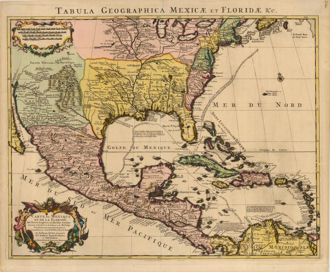
This is Covens & Mortier's issue of Delisle's important map that is credited with accurately showing the course of the Mississippi River and its mouth for the first time. The map influenced later delineations of the Mississippi River by Seutter, Homann, Lotter and others for many years. It is an attractive map that includes much of the present day United States, Mexico, Central America, and the Caribbean. The British colonies are confined along the Eastern Seaboard. Florida is shown as a Spanish possession taking in the entire southern region and the Southwest is labeled Nouveau Mexique. This issue has the route of the Spanish galleons added, and the title in Latin along the top margin. This is a very nice example of this important map.
References: Tooley [Amer] #51; Schwartz & Ehrenberg Plt. 82; cf Cummings (SE) #137; Martin & Martin plt.17.
Condition: A
Lovely, velvety impression and original color. The map has some tiny marginal tears, and the lower margin has been extended, even though the original margin is generous. Professional repair of a small separation in the top centerfold, not entering the map.