Catalog Archive
Auction 120, Lot 114

"Le Canada, ou Nouvelle France, la Floride, la Virginie, Pensilvanie, Caroline, Nouvelle Angleterre et Nouvelle Yorck, l'Isle de Terre Neuve, la Louisiane et le cours de la Riviere de Misisipi", Fer, Nicolas de

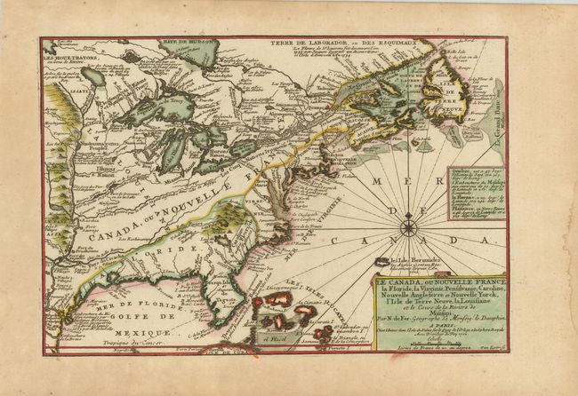
Subject: Colonial North America

Period: 1702 (dated)

Publication:

Color: Hand Color

Size:
13.5 x 9 inches
34.3 x 22.9 cm
Download High Resolution Image
(or just click on image to launch the Zoom viewer)

This small map of Eastern North America shows French and English territorial claims from the French perspective. The British colonies are squeezed along the Atlantic seaboard, while France controls the entire interior. The Mississippi Valley is well delineated and there are numerous notes, locations of forts and Indian names. Simple title cartouche with compass rose and rhumb lines in Atlantic finish the image. The map was engraved by Herman van Loon, a skilled engraved who worked for several important cartographers including Delisle and Nolin.

References: Karpinski, p. 124, pl. 9.

Condition: A

Some light soil, damp stains and wormholes in margins, none affecting map.

Estimate: $850 - $950

Sold for: $750

Closed on 7/18/2007

Archived