Subject: North America
Period: 1780-1840 (circa)
Publication:
Color: Hand Color
The United States and Great Britain established in 1818 joint claim over the Oregon Territory - the region north of Spanish controlled Upper California up to the southern boundary of Russia's Alaska Territory at North latitude 54°40'. By the late 1830's this arrangement was beginning to fall apart.
In the 1840's the expansionist Democrats, including their 1844 presidential candidate, James Polk, claimed the entire region for the United States. Their expansionist desires were expressed by Polk's famous campaign slogan, "Fifty-four Forty or Fight!" The slogan also became a rally cry for Americans desiring to settle the territory. Following Polk's election, the dispute was resolved by the 1846 Treaty of Oregon, which struck a compromise that fixed the U.S./Canadian boundary at 49º North.
This set of maps focuses on the frequently changing configuration of the western United States, and the Oregon Territory in particular.
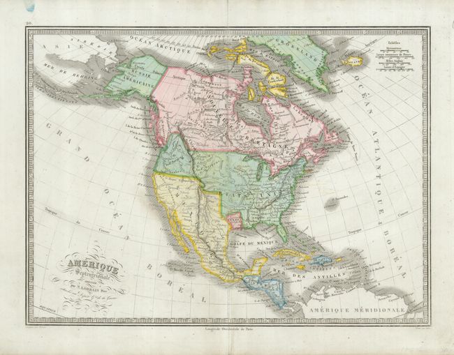
1) Lorrain's Amerique Septentrionale shows Texas as an independent republic. Mexico extends northward to Oregon, and Oregon includes a portion of southwestern Canada. ca 1840. (14.5 x 10.5"). Grade B. Light offsetting, a blue smudge in upper margin and some unobtrusive pencil notations.
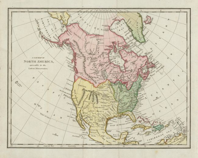
2)A New Map of North America, agreeable to the Latest Discoveries shows "Mexico or New Spain" encompassing Florida and all territory west of the Mississippi River and north to the River of the West. Anon. Ca 1780. (11.3 x 8.5"). Grade A. There is a faint spot in lower margin. Very crisp and dark impression on bright paper.
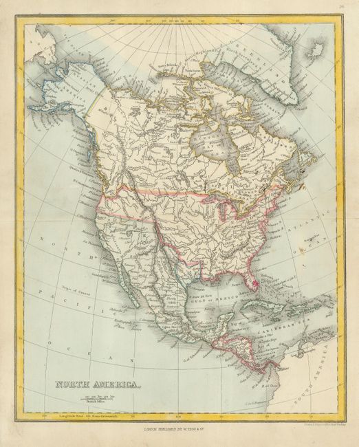
3)North America, engraved by A. Findlay and published by W. Tegg, also shows Mexico in possession of the territory up to Oregon, and Oregon's northern boundary following the Columbia River. ca1840. (8.4 x 10.3") Grade B+. Some scattered, light soiling.
References:
Condition:
See individual descriptions.