Subject: North Pole
Period: 1700 (circa)
Publication:
Color: Hand Color
Size:
20.5 x 16 inches
52.1 x 40.6 cm
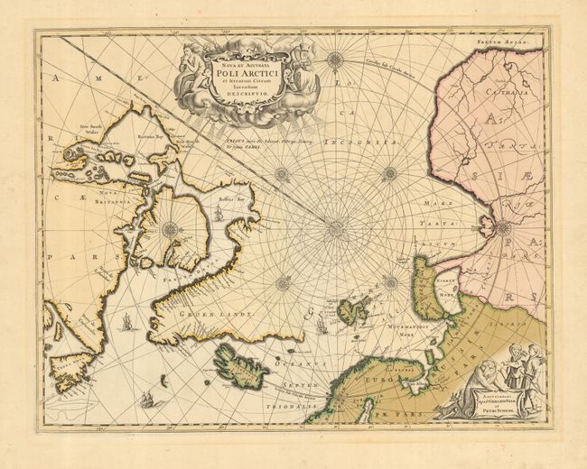
This beautiful map, originally published in 1637, eventually replaced Hondius' map of the North Pole and became the prototype for many later maps including those of Blaeu. Rhumb lines radiate from the North Pole and several compass roses embellish the chart. A large title cartouche, with two figures and numerous wind heads, conveniently hides the northwest coast of America. The map is further decorated with ships and a cartouche depicting men in parkas, a polar bear and foxes. This example is the fifth state of the plate with Nova Zemla connected to the mainland with a land bridge, the completed coastline of Spitzbergen and Valk and Schenk's imprint.
References: Burden #250; Kershaw #111.
Condition: A
This is a handsome, dark impression with original color. There is a faint mat burn in the wide blank margin, not affecting map.