Subject: Atlases
Period: 1904 (dated)
Publication:
Color: Printed Color
Size:
19 x 22 inches
48.3 x 55.9 cm
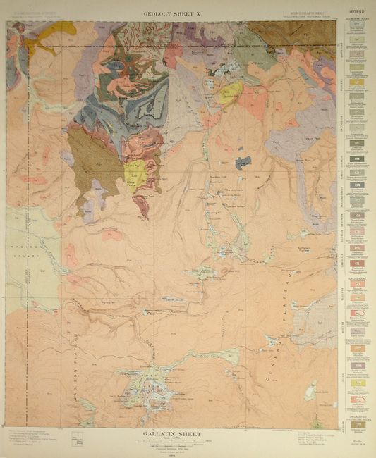
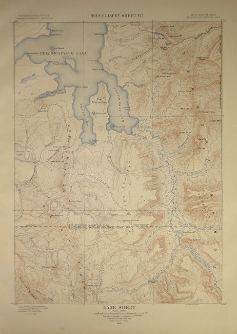
Mapped in the field by Arnold Hague and printed by Julius Bien, this atlas features a series of topographic maps each paired with its richly detailed, color lithography geological version. This fine example of an early geological atlas contains 20 single page, and 7 double page sheets.
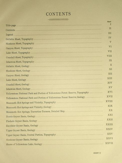
The sheets featured in this atlas are:
Gallitin Sheet, Topography,
Shoshone Sheet, Topography,
Canyon Sheet, Topography,
Lake Sheet, Topography,
Crandall Sheet, Topography,
Ishawooa Sheet, Topography,
Gallitin Sheet, Geology,
Shoshone Sheet, Geology,
Canyon Sheet, Geology,
Lake Sheet, Geology,
Crandall Sheet, Geology,
Ishawooa Sheet, Geology,
Yellowstone National Park and Portion of Yellowstone Forest Reserve, Topography
Yellowstone National Park and Portion of Yellowstone Forest Reserve, Geology
Mammoth Hot Springs and Vicinity, Topography
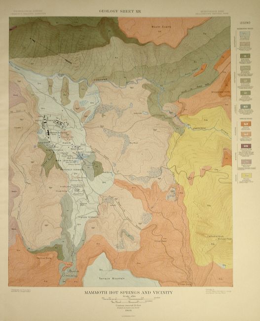
Mammoth Hot Springs and Vicinity, Geology
Mammoth Hot Springs, Travertine Terraces, Detailed Map
Norris Geyser Basin, Geology
Firehole Geyser Basin, Geology
Excelsior Geyser Basin,
Upper Geyser Basin, Geology
Shoshone Geyser Basin, Geology
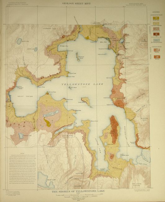
and Shores of Yellowstone Lake, Geology.
Rarely does one encounter a 100+ year old book in near-new condition, as this atlas is.
Hardbound in brown cloth with gilt title on front cover. Elephant folio. Comprised of a Title Page, Table of Contents, a Legend detailing the topography and geology of Yellowstone, and 24 maps.
References:
Condition: A+
Very slight shelf wear and bumping to the corners and edges. All the sheets are clean, crisp and without flaws.