Subject: Pacific Ocean and Australia
Period: 1845 (circa)
Publication:
Color: Hand Color
Size:
13 x 15.5 inches
33 x 39.4 cm
The beginning of the nineteenth century saw a period of rapid market growth and innovation in the map publishing world. Increased literacy and public interest in new frontiers and colonies overwhelmed the market because it was oriented toward the small, affluent market of the previous century. With the intent to fill this void, The Society for the Diffusion of Useful Knowledge (SDUK) was founded in 1828 in London, by Lord Brougham and a group of men dedicated to the education of the aspiring working class and the Utilitarian ideal of 'Knowledge is Power.' The society produced an array of education materials, but the series of maps was one of their most successful ventures. A number of engravers and printers were used to produce the maps, which eventually exceed 200 sheets, and continued to be published after the Society as a whole ceased to function.
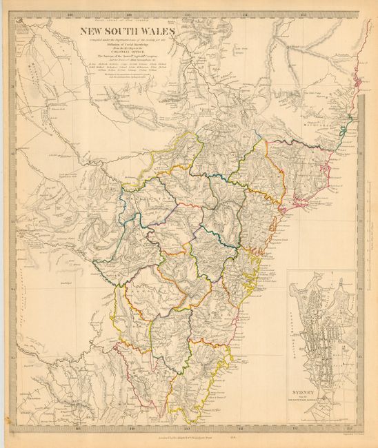
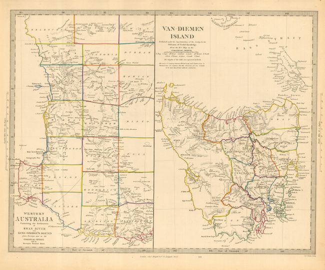
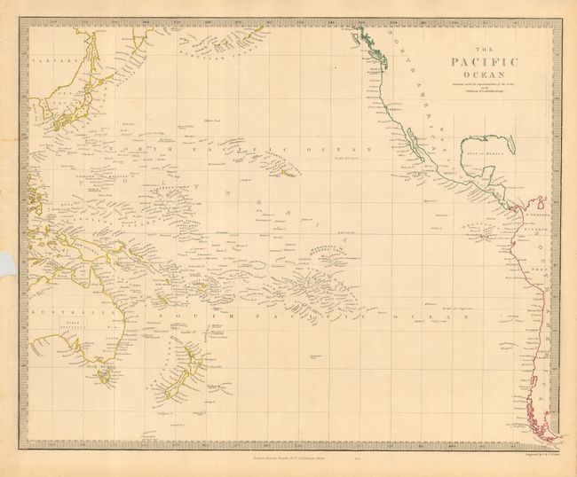
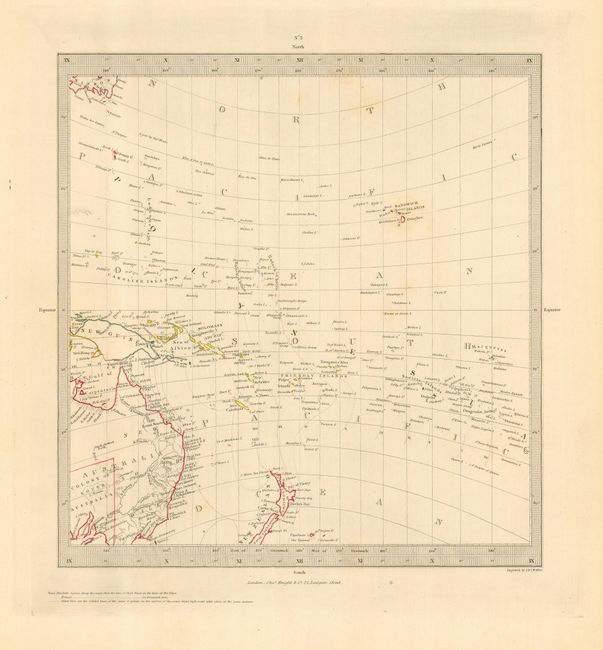
Nice lot of detailed maps related to Australia and the Pacific Islands. The map of New South Wales presents an incredibly detailed view of the thriving colony compiled "From the M.S. maps in the Colonial Office, the Surveys of the Australian Agricultural Company, and the Routes of Allan Cunningham." The counties are colored in outline and the eastern part of the map is detailed with topographical features and interesting notations. A large inset plan of "Sydney from the New South Wales Almanack" marks important buildings including Bathing Houses and the Albion Brewery. The second map is in two parts. It shows the county development of both Western Australia, from Perth to St. George's Sound, and all of Tasmania and the Bass Strait. The maps of the Pacific present a comprehensive view of the islands. All with keyboard style borders.
References:
Condition:
All very good except the map of the Pacific, which has several short tears (one entering border) and a large chip (nearly touching neatline) in left border.