Subject: Russia
Period: 1750 (circa)
Publication:
Color: Hand Color
Size:
22.8 x 19.5 inches
57.9 x 49.5 cm
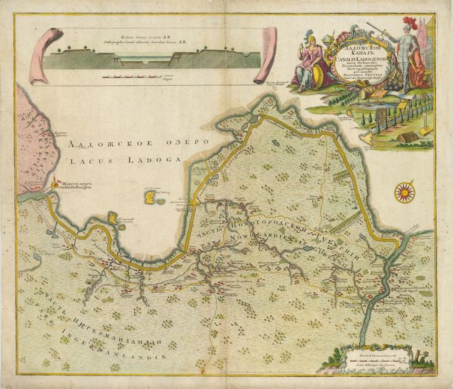
This handsome map illustrates the Lodoga Canal, one of the impressive projects initiated by Peter the Great in 1708 and completed by Empress Anna in 1732. The canal was built because frequent storms and high waves on the lake made it treacherous for boat traffic. A system of four sluice gates kept the level of the canal two meters higher than the level of the lake, with water fed from specially constructed reservoirs. It followed the southern coast of the lake, from the river Volkhov up to source of the Neva and the fortress at Shlisselburg. It is now a part of the Volga-Baltic Waterway. A prospect at top shows a cut-away view of the canal and the elaborate title cartouche further illustrates this engineering masterpiece. Title and notations are also printed in Russian/Cyrillic.
References:
Condition: B
Some surface soil with tissue repair on centerfold. Tissue reinforced paper edges to repairs several tiny edge tears.