Subject: Ireland
Period: 1676 (circa)
Publication: Theatre of the Empire of Great Britaine
Color: Hand Color
Size:
20 x 15 inches
50.8 x 38.1 cm
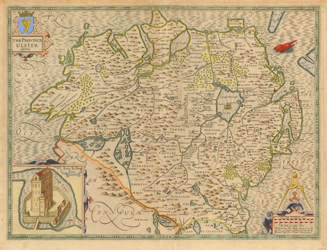
This is a fine, decorative map of the northern province of Ulster, present-day Northern Ireland. Speed's map reflects the 16th century political turmoil and military struggle between the English and Irish with several fortifications in County Tyrone, Armagh and Monaghan, built after the rebellion of 1593. The sturdy fortress of Enniskillen (Enis Kelling Fort) in County Fermanagh is inset and the map is embellished with a decorative title cartouche, a scale of miles with large calipers and fine lettering and ornamentation throughout. A sea monster patrols the moire patterned sea. A desirable example of Speed's beautiful work, here with the imprint of Bassett & Chiswell. Related English text on verso.
References:
Condition: A
Gently toned with light mat burn in blank margin. Remnants of hinge tape on verso.