Subject: Exploration and Surveys
Period: 1854 (dated)
Publication: 33rd Cong. 2nd Session, Sen. Ex. Doc. No. 1, Part III
Color: Black & White
Size:
9 x 12 inches
22.9 x 30.5 cm
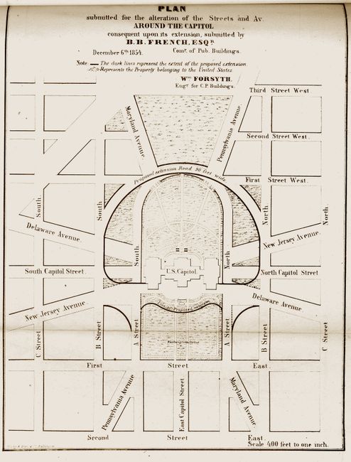
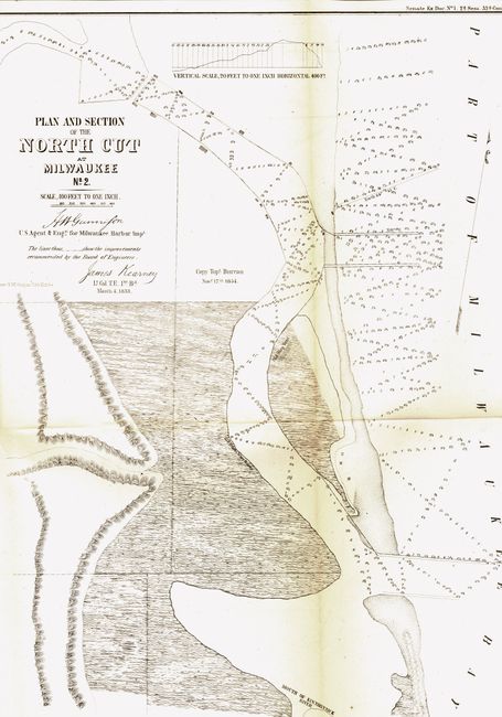
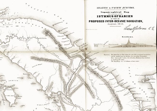
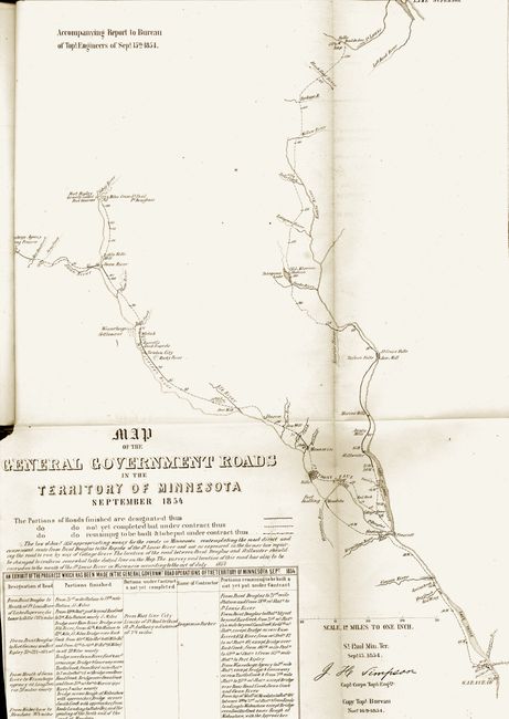
Book of foldout state surveys, harbors, etc, published for Congress in 1854-5. There are 8 state survey maps (Michigan, Arkansas, Louisiana, Florida, Wisconsin & Minnesota, Iowa, California, Kansas & Nebraska) to accompany the Report of the Commissioner of the General land Office, 4 plans to accompany the Report of the Commissioner of the Public Buildings, 1 plan to accompany the Report on the National Hospital for the Insane and 30 of 31 plans and charts of bays and harbors to accompany the Report of the Colonel of Topographical Engineers. Map #17 Sketch of Vermillion Harbor, Ohio is missing. Of particular interest is the Topographical Map of a Portion of the Isthmus of Darien, in site of Proposed Inter-Oceanic Navigation. Original hardbound in embossed cloth with gilt titles.
References:
Condition: B
Most of the maps and views have toning and foxing. Several have binding tears and intersection fold separations. Some tears have traveled into the images. Cover shows heavy shelf wear and bumping with cloth separations on spine.