Subject: Russia - St. Petersburg
Period: 1744 (dated)
Publication:
Color: Hand Color
Size:
23 x 19.5 inches
58.4 x 49.5 cm
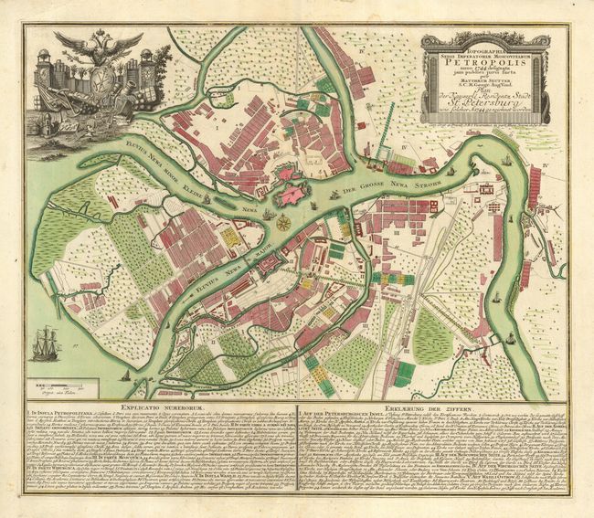
Very lovely plan of St. Petersburg showing the Neva River and the surrounding countryside. This map shows the Peter & Paul Fort, that protects the Cathedral of St., Peter & Paul. There are two numbered keys at the bottom in both Latin and German. Ships, warship and boats are afloat in the Neva River. There are two decorative cartouches, one naming the place mapped within an architectural surround, the other filled with beautifully engraved images of the martial prowess of Russia, including cannon, forts, a warship and globes surmounted by the crest of the Russian Empire.
References:
Condition: B
Some short tears in the generous, blank margins. There are a few scattered, light stains and a horizontal tear closed with archival tape. These minor flaws are offset by the fine engraving and the superb original color.