Subject: Southwestern United States
Period: 1871 (dated)
Publication: Senate ex. Doc. 65, 42nd Cong., 2nd Sess.
Color: Black & White
Size:
22 x 28 inches
55.9 x 71.1 cm
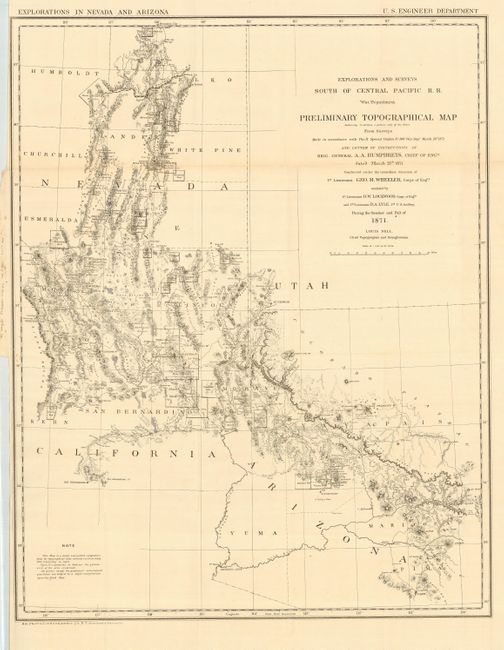
This map was the result of Wheeler's spectacular exploration of 1871. The Interior Department's civilian surveys of Powell and Hayden posed a major threat to funding for military mapping and exploration efforts. Wheeler, barely 30 years of age, was tasked to gather information and produce a highly accurate map of the area. He accomplished this and in so doing conceived of the U.S. Geographical Surveys West of the One Hundredth Meridian, of which this map is the forerunner. The map is very detailed with scores of mining districts located and named. Locates Prescott, St. George, San Bernardo, Elko, Ely, and Tucson. Wheat refers to it as a "map of great interest." The map displays a portion of Nevada together with parts of California, Utah and Arizona, as bounded by Tucson, San Bernardino and the Sierra Nevadas, St. George, and north to Mountain City, above Elko. Topography shown via hachure. A very nice example of this increasingly difficult to find map
References: Wheat [TMW] 1237.
Condition: A
Nice impression with full margins. Hint of toning and a couple small fold intersection splits, else fine.