Subject: North America
Period: 1778 (published)
Publication:
Color: Black & White
Size:
14.5 x 9.2 inches
36.8 x 23.4 cm
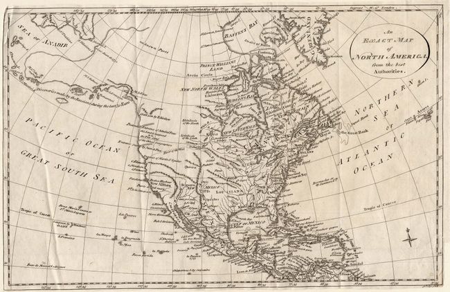
This map of the continent was issued before the Cook discoveries were published and details the discoveries made by Russian explorers "during the last 30 years." An early shape for Alaska is displayed in skeleton format with its northern portion labeled unknown Parts. Kodiak Island is here called I. Tumannoi. In the Pacific Northwest are the entrances to Admiral Fonte's infamous Northwest Passage (labeled Pretended), and the strait of Juan de Fuca. The River of the West is timidly shown as a dotted line between the Entrance of Martin d'Aguilar on the Pacific and the region of the St. Charles and Mantons rivers. In the East, numerous cities, Indian tribes and the colonies are named.
References:
Condition: B
Good impression on thick hand laid paper. Binding at lower right trimmed to just outside neatline, else very good.