Catalog Archive
Auction 116, Lot 40
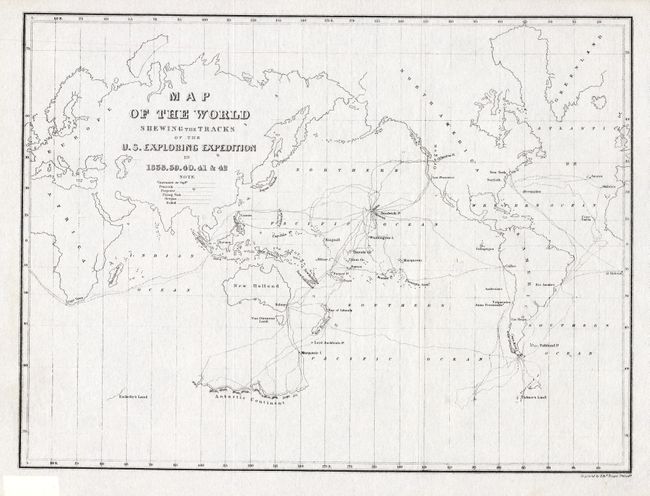
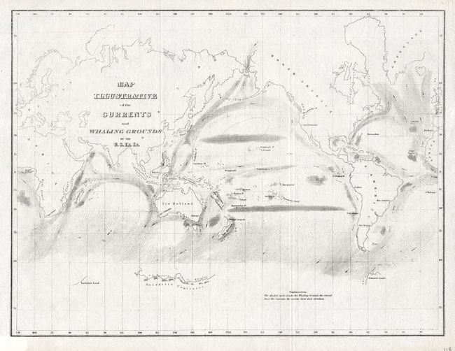
"[Lot of 2] Map of the World Shewing the Tracks of the U.S. Exploring Expedition in 1838, 39, 40, 41 & 42 [and] Map Illustrative of the Currents and Whaling Grounds", Wilkes, Charles
Subject: World
Period: 1849 (circa)
Publication: Narrative of the United States Exploring Expedition…
Color: Black & White
Size:
11.3 x 8.4 inches
28.7 x 21.3 cm
Download High Resolution Image
(or just click on image to launch the Zoom viewer)
(or just click on image to launch the Zoom viewer)