Catalog Archive
Auction 116, Lot 274

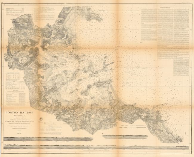
"Boston Harbor, Massachusetts From a Trigonometrical Survey…", U.S. Coast Survey

Subject: Massachusetts, Boston

Period: 1872 (dated)

Publication: U.S. Navy

Color: Black & White

Size:
35.8 x 28.2 inches
90.9 x 71.6 cm
Download High Resolution Image
(or just click on image to launch the Zoom viewer)

This is one of the finest charts produced by the Coast Survey, fully and beautifully engraved with as much detail on land as along the coastline. The chart is filled with hundreds of soundings, plus anchorages, hazards, bottom type, and tables of buoys, light houses, and tides. The inland detail including roads, houses, fields, villages and railroads is truly remarkable. Lengthy notes provide sailing directions. Seven sea view elevations show the land from various approaches. This is the revised edition from the 1867 chart.

References:

Condition: B

Issued folding, now flat with several clean fold splits closed on verso. Toned along folds.

Estimate: $220 - $275

Sold for: $160

Closed on 9/20/2006

Archived