Subject: California
Period: 1852 (dated)
Publication:
Color: Hand Color
Size:
22.7 x 21.8 inches
57.7 x 55.4 cm
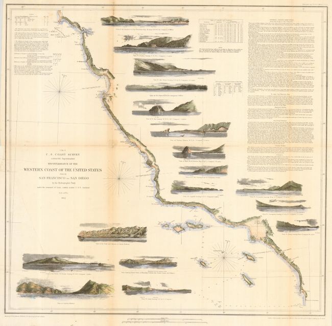
Terrific chart that delineates the coast from the first official scientific reconnaissance of the Pacific coast. This map is one of three prepared by Lieutenant James Alden for this important survey. This sheet covers the region from the Mexican boundary to Point Reyes. It outlines the coastal littoral, shows dangerous reefs and shoals, gives offshore bathymetric soundings, plus general and specific harbor sailing instructions. The most impressive feature is the 17 views of entrances and promontories along this rugged coastline - among them Santa Barbara, Catalina Harbor, and the entrance to San Francisco Bay. The map was drawn by W.M. McMurtie and engraved by G. McCoy. Engraving of the views is also by McCoy and S.V. Hunt. One of the finest Coast Survey charts produced.
References: Schwartz & Ehrenberg, plt. #174; Heckrotte & Sweetkind #33.
Condition: B
Issued folding, now backed with archival tissue. Toned along two folds with slight loss at one fold intersection.