Subject: North America
Period: 1750 (circa)
Publication:
Color: Black & White
Size:
11.5 x 8.6 inches
29.2 x 21.8 cm
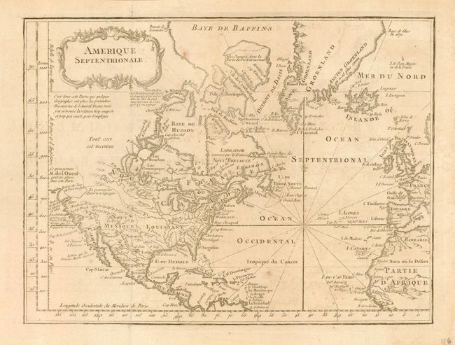
Nice map with good detail of topographical features. There is a dotted line from the Missouri River to the Straits of Juan de Fuca alluding to the supposed Northwest Passage. The Canadian lakes, Lac Gouinipique and Lac Bourbon are very oversized and appear to be the source of the Mississippi. Several notations concern recent discoveries. Map depicts all of the Atlantic with a good bit of Europe and Africa as well. This map illustrated Chambon's important work in colonial history, which contained all the French laws and ordinances on the commerce, particularly the slave trade. The map is based on Jacques N. Bellin's 1755 map of North America with the western region mostly blank.
References:
Condition: B
On a sheet of hand laid paper with original margins. A few very light spots and some nearly invisible offsetting, else very good. Issued folding, now flat and professionally encapsulated in archival Mylar.