Subject: Western Hemisphere
Period: 1762 (dated)
Publication: Atlas Moderne
Color: Hand Color
Size:
17.5 x 12 inches
44.5 x 30.5 cm
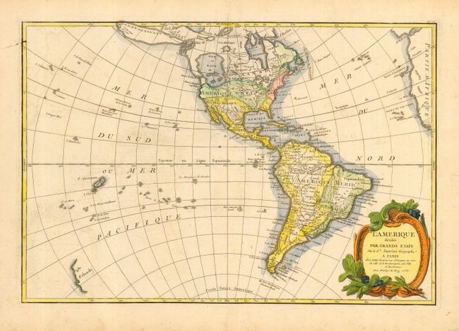
A fine map of the Americas that features a huge, imaginary Sea of the West and hints of a possible Northwest Passage. Alaska is shown in an early configuration with a rough shape incorporating the Aleutians, and notations concerning the coastline discoveries in 1741 by the Russians. There are several islands shown in the Pacific and just the western coastline of New Zealand. In North America, the British colonies are shown east of the mountains, French Louisiana takes in most of the interior and Spain controls Florida. A superb example that has been professionally encapsulated in archival Mylar.
References:
Condition: A
Crisp, early impression with very fine coloring on a sheet with wide, original margins. This map is near fine with only some light offsetting in blank oceans and small ink spot at upper left neatline.