Subject: Western Hemisphere
Period: 1659 (circa)
Publication: Introductionis in Universam Geographicam
Color: Hand Color
Size:
4.9 x 4.8 inches
12.4 x 12.2 cm
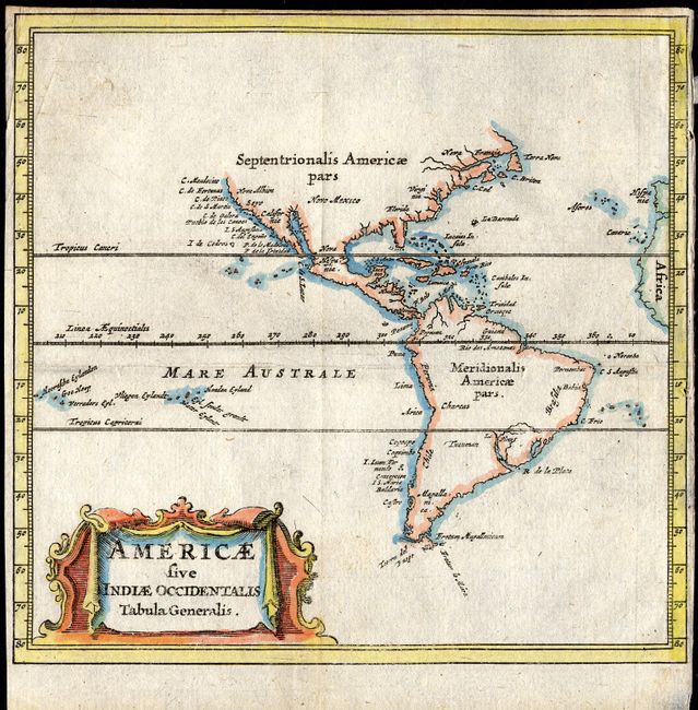
This tiny map is a reduced version of the important 1630 map by De Laet. It is a simple map of the coastlines of the Americas with many rivers and bays and a few place names. The most notable place named on the East Coast of North America is C. Cod. By comparison, the west coast shows many place names. There are no Great Lakes shown in North America and conspicuously absent is the mythical Lake Parime in South America. It is adorned with a relatively large title cartouche.
References: Burden #335
Condition: A
Delicate impression and fine coloring. Map image is very good with just a trace of soiling at on blank corner. However the margins are trimmed nearly to the neatline at side and top.