Subject: Near and Middle East
Period: 1753 (dated)
Publication: Atlas Universel
Color: Hand Color
Size:
24.5 x 18.5 inches
62.2 x 47 cm
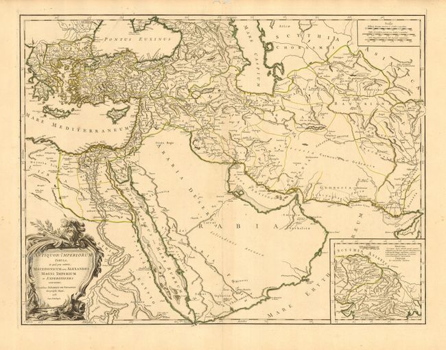
First state of this large map is centered on Arabia and details ancient Asia Minor and the Holy Land. This finely engraved map extends to the Caspian Sea in the north, west to show Greece, east to the Indus River, and south to include all the Red Sea and the Nile River valley. There is good detail of topography, deserts, towns and villages, etc. The interior of Arabia is very nearly blank. The campaigns of Alexander the Great (356-323 B.C.) are traced. Large inset shows northern India from the Indus River and the region of the Asiatic Sythians, with notes on Alexander the Great explorations. Decorative rococo-style title cartouche. Manuscript page number 4 at upper right.
References: Pedley #382.
Condition: A
Fine impression with original outline coloring and very wide margins. Hint of centerfold toning, overall very good. Some worm tracks in blank margins.