Subject: Italy
Period: 1820 (circa)
Publication:
Color: Hand Color
Nice pair of maps detailing Italian regions.
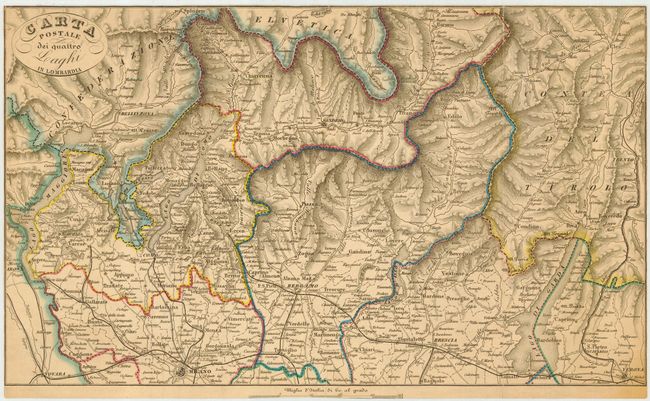
1) Carta Postale dei quattro Laghi in Lombardia is a scarce Italian postal map, centered roughly on Bergamo, covers the region from Lago Maggiore east to Largo di Garda, north to the Alps, and south to below Milan. Symbols are used to indicate the frequency of postal delivery. However there is no legend, perhaps suggesting the map has been trimmed out of a larger sheet. Below the map is a partially trimmed distance scale. (16.3 x 9.7")
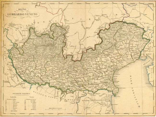
2) Regno Lombardo - Veneto shows the northern portion of Italy bordering Switzerland. The area shown includes the Adriatic coastline, and the political divisions are shown with a numbered key at the bottom. (15.0 x 11.3")
References:
Condition: C
Map 1 is near fine, but the margins have been trimmed to just outside the neatlines. Crisp impression and original coloring. Archival tape reinforcing a couple of folds on verso. Map 2 has fold separations with a few areas of loss and a repaired tear into the map about 1.5 inches. Trimmed margins.