Subject: North Pole
Period: 1684 (circa)
Publication:
Color: Hand Color
Size:
20.8 x 16.3 inches
52.8 x 41.4 cm
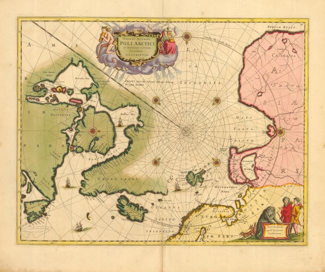
This beautiful map, originally published in 1637, eventually replaced Hondius' map of the North Pole and became the prototype for many later maps including those of Blaeu. Rhumb lines radiate from the North Pole and several compass roses embellish the chart. A large title cartouche, with two figures and numerous wind heads, conveniently hide the northwest coast of America. The map is further decorated with ships and a cartouche, with Jansson’s imprint, which depicts men in parkas, a polar bear and foxes. This example is the fourth state of the plate with Nova Zemla connected to the mainland with a land bridge and the completed coastline of Spitzbergen. No text on verso, issued by Visscher.
References: Burden #250; Kershaw #110.
Condition: B
Fine impression and original color with slight oxidation of the green color. Paper is still very sound. Old paper repair of bottom fold separation affecting 1" into map.