Subject: Ancient World
Period: 1892 (dated)
Publication:
Color: Printed Color
Size:
180 x 11 inches
457.2 x 27.9 cm
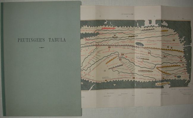
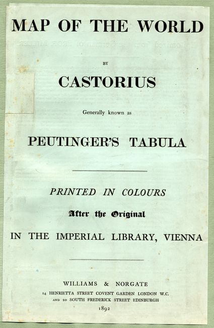
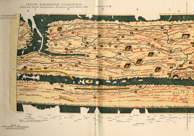
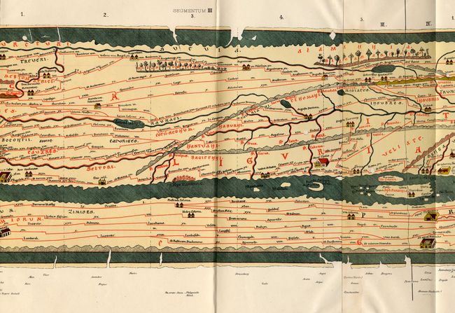
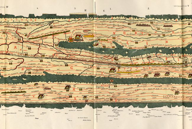
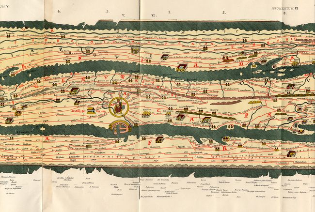
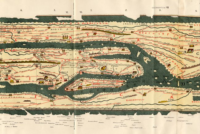
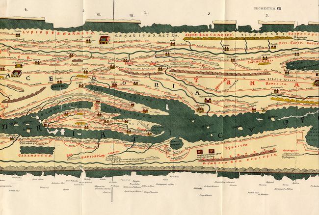
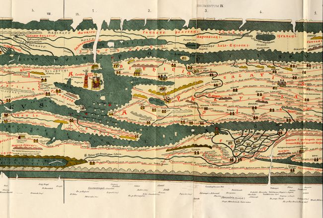
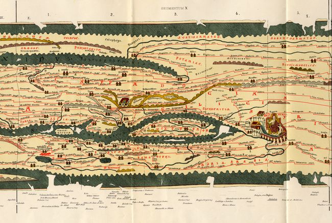
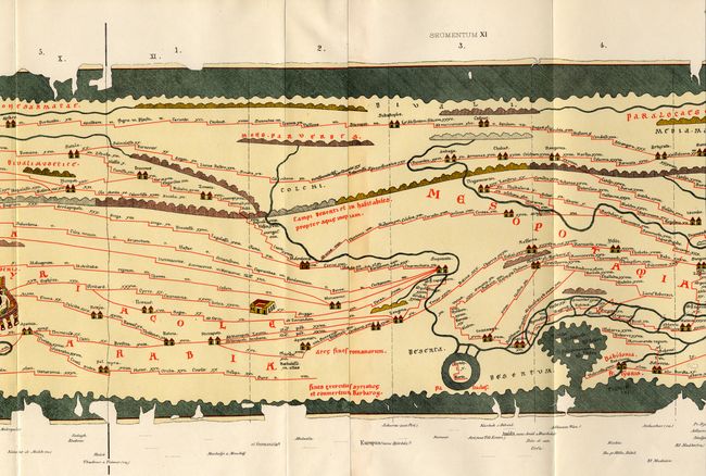
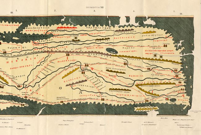
A very uncommon reproduction of the famous Peutinger Table in the Imperial Library at Vienna, printed by Williams and Norgate. The Peutinger Table is a Roman road map of the world. The chart depicts the imperial roads and posts within the Roman Empire throughout Europe, North Africa and Asia as far as Toprobana (Sri Lanka). The original parchment document was found by Konrad Celtes in a library in Augsburg, came into the hands of Konrad Peutinger and later went to his relative Mark Welser who was the first to publish a copy of it in 1591 at Aldus Manutius in Venice. Rebound in paper covered boards enclosing the original paper covers.
References:
Condition: A+
Map in remarkable condition for a folding map of this size. Fine modern binding.