Subject: Ancient World
Period: 1506 (circa)
Publication: Nouissime historiaru
Color: Black & White
Size:
5.2 x 3.4 inches
13.2 x 8.6 cm
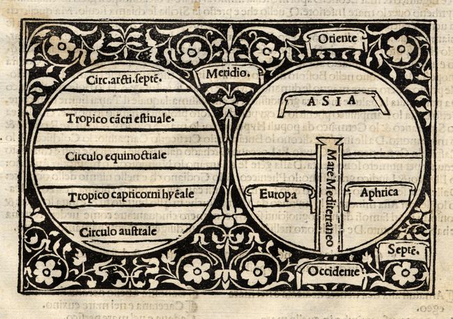
This little map is a fine example of the medieval world concept expressed in a simple circular diagram containing the three known continents. The circle represents the boundary of the world with east oriented at the top. The 'T' is formed by the perpendicular axis representing the Mediterranean Sea and the horizontal line being the meridian running from the Don to the Nile. Asia fills the top with Europe at left and Africa at right. To the left of the map is another diagram showing the climatic zones of the world. These are surrounded by a boldly engraved floral border. On a full sheet of Italian text. Giacomo Filippo Foresti, also know as Jacobus Philippus Foresti da Bergamo or Burgomensis (1434-1520), was an important historian and biblical scholar of the incunabula period.
References: cf Shirley Plate 2.
Condition: A
Fine crisp impression. Bit of light foxing in text.