Subject: England
Period: 1760 (published)
Publication: Great Britain's Coasting Pilot
Color: Hand Color
Size:
22.2 x 17.5 inches
56.4 x 44.5 cm
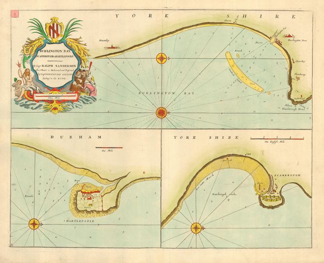
This very handsome chart shows the coast of Yorkshire with three engraved charts on one sheet of Bridlington (Burlington Towne), Scarborough and Hartlepool. Each chart is oriented with a decorative compass rose with rhumb lines & bearings. Soundings appear along the shore with shoals, sandbars, channels, rocks and anchorages. The chart is embellished with a decorative cartouche in a nautical theme including Neptune with his trident.
In 1679 Collins was appointed Hydrographer to the King by Charles II. In 1681 he was appointed by the Admiralty to make a complete survey of the coasts of Great Britain. Prior to this date the charts used by English mariners were copies of Dutch charts that had many inaccuracies. The task of surveying the entire coast was formidable and took nearly a decade. The Coasting Pilot, containing 48 charts, was first published in 1693 with editions continuing until 1792.
References:
Condition: A
Nice impression and fine later color. Printed on heavy paper with a small paper flaw (thin paper) in the Scarbrough map, else fine.