Catalog Archive
Auction 115, Lot 238

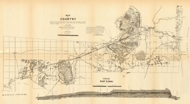
"Map of the Country Embraced in the Preliminary Survey and Examination of the Peninsula of Florida with a View to the Construction of a Ship Canal from the St. Mary's River to the Gulf of Mexico.", U.S. Corps of Engineers
Subject: Florida

Period: 1879 (dated)

Publication: Sen Ex. Doc. 38, 47th Cong., 1st Sess.

Color: Black & White

Size:
28.5 x 15 inches
72.4 x 38.1 cm
Download High Resolution Image
(or just click on image to launch the Zoom viewer)

Detailed lithographed map made in 1879 under the direction of Bvt. Maj. Gen Q.A. Gillmore Lieut. Colonel of engineers by S.L. Fremont Civil Asst. Eng'r. This detailed map of the watershed between Tallahassee and Jacksonville extends north to include Brunswick and locates St. Marks, Lake City, Sanderson, Baldwin, etc . A proposed ship canal from St. Mark's to the Gulf, another recommended barge canal route, plus feeder canals are shown. Details include the Okefenokee Swamp, San Pedro Bay and more. Locates the Central R.R., Florida R.R., and the J.P. & M. R.R. Along the bottom is a "Profile on Line of Proposed Ship Canal". The canal was never constructed.

References:

Condition: A

Folding, as issued. Very nice copy with a hint of toning at folds, else fine.

Estimate: $80 - $120

Sold for: $60

Closed on 6/21/2006

Archived