Subject: North America
Period: 1849 (circa)
Publication: Atlas Universel Illustre
Color: Hand Color
Size:
16.6 x 11 inches
42.2 x 27.9 cm
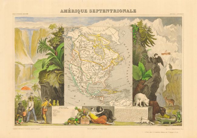
Victor Levasseur's "Atlas National Illustre" and "Atlas Universel Illustre" are among the last decorative atlases published. The maps are all lavishly illustrated with scenes of the countryside, products and activities indigenous to the region.
Lovely map with the United States that extends into present-day Canada, with Russia in control of Alaska, and Mexico's northern border according to the Treaty of 1819 (misprinted 1810). Surrounded by beautifully engraved scenes of North and Central America including local animals, a ship stranded in the polar sea, and a Mayan Temple. A very popular and decorative 19th century map.
References:
Condition: A+
Fine original outline coloring to map and modern hand coloring to surrounding scenes. Nice impression and wide original margins. Lovely ivory paper. Previous owners embossed stamp at lower neatline.