Catalog Archive
Auction 114, Lot 294

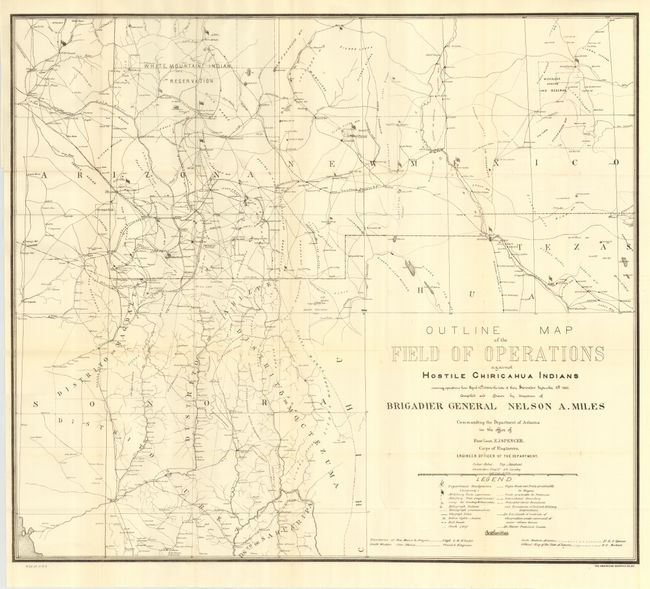
"Outline Map of the Field of Operations Against Hostile Chiricahua Indians Showing Operations from April 12th, 1886 to the Date of Their Surrender September 4th, 1886", U.S. War Department

Subject: Southwest United States & Mexico

Period: 1886 (dated)

Publication: HR Ex 1 pt2 v1, 49th Cong., 2nd Sess.

Color: Black & White

Size:
29 x 25.3 inches
73.7 x 64.3 cm
Download High Resolution Image
(or just click on image to launch the Zoom viewer)

Compiled and Drawn by direction of Brigadier General Nelson A. Miles. By the summer of 1874 Gen. Crook was considered to have largely pacified the Apache. Shortly thereafter, following the death of Cochise, trouble again broke out (mostly with the Chiricahua) in Arizona and New Mexico and continued sporadically for the next ten years under the leadership of Geronimo. In 1886 Gen. Miles replaced Crook and initiated a military campaign against the Apache. Eventually, Geronimo was forced to surrender. Those that could be rounded up, including the Apache scouts who had served Miles so well, were packed off to Florida as prisoners. This map shows, in considerable detail, Indian fights, military posts, heliograph stations, railroads, wagon roads, and much more. An important map in the history of the Southwest and Apache country.

References:

Condition: A

Folding, as issued. Near mint example.

Estimate: $180 - $220

Sold for: $160

Closed on 3/1/2006

Archived