Subject: Gulf of Mexico, Florida and Peru
Period: 1606 (circa)
Publication: Theatrum Orbis Terrarum
Color: Hand Color
Size:
18.3 x 13 inches
46.5 x 33 cm
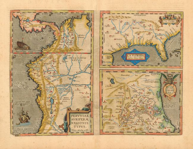
This is one of the few sixteenth century maps based on Spanish sources; in this case drawn from reports of Hernando de Soto's expedition through the region. There are three maps on this sheet. The most important map (La Florida) is the first printed map of the southeastern portion of the United States. This influential map provided the foundation cartography for the region, particularly in the depiction of the river system. The map below (Guastecan Reg) combines with La Florida to extend the coastline of the Gulf of Mexico further south. The third is a map of Peru, where de Soto was the first Spaniard to meet Inca Emperor Atahuallpa. Latin text on verso from an edition after 1606 when the lower left corner of the copper plate broke off.
References: Burden #57; Cumming (SE) #5; Van den Broecke #15.
Condition: A
Attractive old color. Bit of light foxing in blank margins and professional repairs on centerfold, not affecting maps.