Catalog Archive
Auction 113, Lot 804

"Carte et Vues de l'Isle Pitcairn", Benard, Jacques Francois

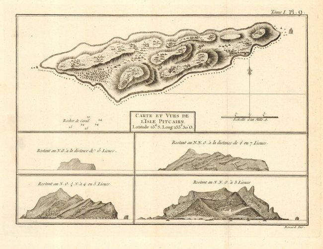
Subject: Pacific - Pitcairn Island

Period: 1774 (circa)

Publication: Hawkesworth's Cartes et Figures des Voyages…

Color: Black & White

Size:
9.8 x 7 inches
24.9 x 17.8 cm
Download High Resolution Image
(or just click on image to launch the Zoom viewer)

Small map of the rocky island with four sailor's prospective views below. Pitcairn Island was discovered by Admiral Carteret and named for Robert Pitcairn, the midshipman that first sighted the island in 1767. One of the most romantic tales of the Pacific centers on the remote Pitcairn Island, located southeast of the Tuamotu Archipelago. In 1790 nine mutineers from the British ship Bounty, accompanied by 18 Polynesians, sought refuge on the island and remained hidden until the small colony was discovered in 1808.

References:

Condition: A+

Estimate: $100 - $150

Sold for: $130

Closed on 12/7/2005

Archived