Subject: Africa
Period: 1610 (circa)
Publication: Atlas sive Cosmographicae
Color: Hand Color
Size:
18.5 x 15 inches
47 x 38.1 cm
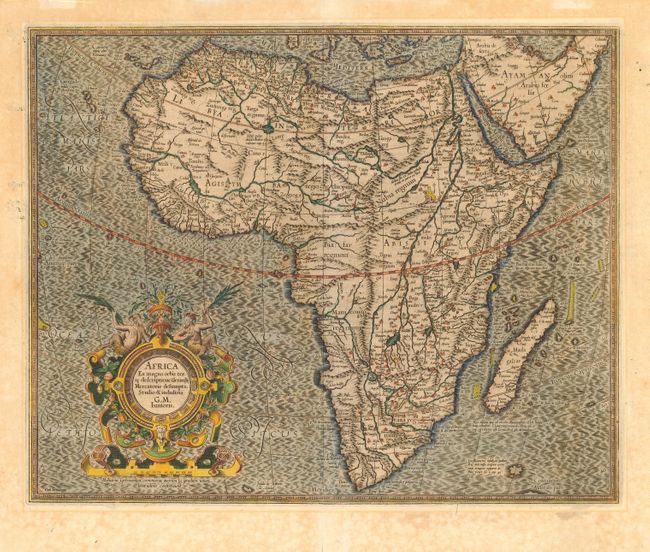
Compiled from Gerard Mercator's world map of 1569, this map was drawn by Mercator's grandson (also named Gerard) in 1595, and published later by Hondius. The map is typical of 16th century cartography with considerable fantastic detail in the interior. The depiction of the Nile is based on Ptolemy's geography with some complex modifications from various sources, including Abyssinian monks. The source of the Nile is shown as a series of lakes located in the Lune montes just north of the Tropic of Capricorn. Another branch of the Nile flows from the west, with this system rambling through what is the Sahara Desert. In Abissini, Mercator shows Prester John sitting on his throne. The engraving, especially the boldly engraved oceans, beautiful calligraphy, and strapwork cartouche (surmounted by two satyrs) make this a decorative masterpiece. French text on verso.
References: Norwich #21.
Condition: A
Good impression and attractive color. Light scattered foxing in blank margins with faint mat burn from a previous framing. Professional repairs on minor fold separations.