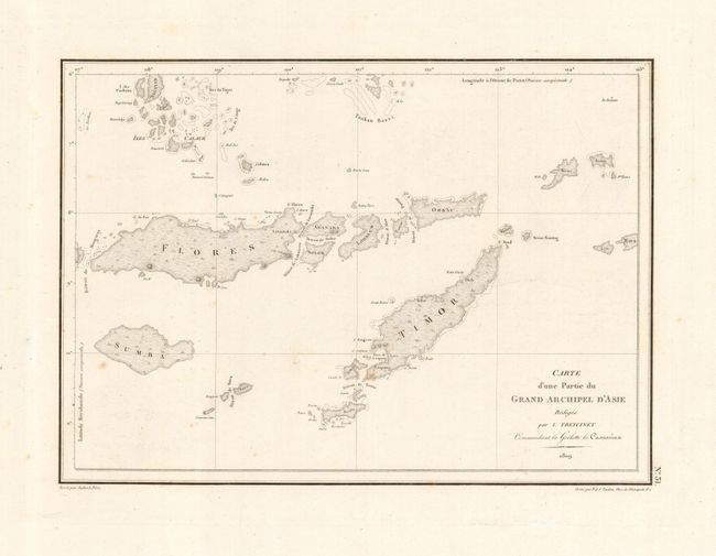
Subject: East Indies - Indonesia
Period: 1809 (dated)
Publication:
Color: Black & White
Size:
11 x 8 inches
27.9 x 20.3 cm
Delicately engraved map of the Indonesian islands of Flores, Sumba, Lomblem, Alor and Timor. Freycinet was a French marine officer and explorer, who participated in several significant early 19th-century expeditions to relatively unknown areas in the southern hemisphere. In 1800, he joined one of the most important early explorations of Australia, which was commissioned by the French government and commanded by Nicholas Baudin. On this voyage Freycinet served as a surveyor and was responsible for conducting a thorough cartographic survey of the Australian coast and the nearby Indonesian archipelago.
References:
Condition: B
Few light spots of foxing, mostly in margins.