Subject: Poland
Period: 1816 (circa)
Publication: New General Atlas
Color: Hand Color
Size:
23.7 x 19.5 inches
60.2 x 49.5 cm
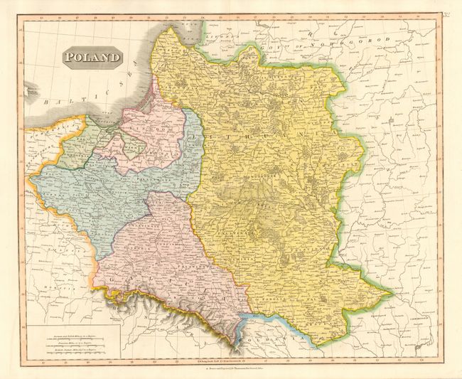
Great map of Poland that extends from the Oder River in the west and the Dnieper River in the east, as well as north of the Carpathian Mountains to the Baltic Sea; thus extending from modern day Poland into parts of modern Lithuania, Belarus and Ukraine. Many place names including Prussia, Pomerenia, Warmia, Galicia, Podolia, Braclaw, Kiow, Wolhinia, Brzesc, Samogitia, etc. At this point Prussia occupies only a small portion of north eastern Poland and is not in control of Warsaw.
References:
Condition: A+
Fine impression and coloring. One tiny tear in margin.