Subject: North Pole
Period: 1650 (circa)
Publication:
Color: Hand Color
Size:
21 x 16 inches
53.3 x 40.6 cm
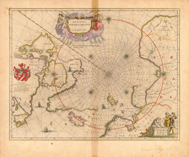
This is one of the prototype maps of the Arctic. It incorporates new information from the explorations of Capt. Thomas James with the bay named for him labeled here James his Bay. The Arctic coast of Russia provides information from Willem Barentsz' voyage and Spitsbergen is shown according to the Danish expedition of James Hall. It depicts rhumb lines radiating from the North Pole. A large title cartouche, with two figures and numerous wind heads, conveniently hides the northwest coast of America. The map is further decorated with several compass roses, ships and an additional cartouche that features men in parkas, a polar bear and foxes. Dedication to Guilielmo Backer de Corneliis (signed by Joan Blaeu), which indicates this issue is from the second state of the plate. French text on verso.
References: Burden #252; Goss (Blaeu) #2; Manasek #51.
Condition: B
Good impression and original color. Toned on centerfold, darker in blank margins. Short fold separations not entering map.