Catalog Archive
Auction 113, Lot 313

"A New Map of the English Empire in the Ocean of America or West Indies", Senex, John
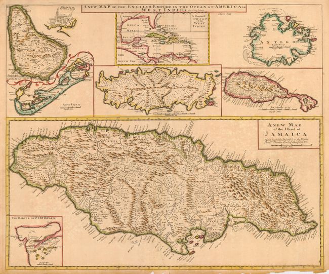
Subject: Caribbean

Period: 1721 (circa)

Publication: New General Atlas

Color: Hand Color

Size:
24 x 20 inches
61 x 50.8 cm
Download High Resolution Image
(or just click on image to launch the Zoom viewer)

An uncommon large map with eight maps on a single sheet. The major map is of Jamaica with its parishes and very fine detail and notations throughout and an inset map Port Royal harbor. Arrayed at top are maps of Barbados (with an inset of Bridgetown), the entire West Indies, Antego, St. Christophers, Tobago and Bermuda. This is a revised version of Christopher Browne's map of 1690 with Senex's imprint in title.

References:

Condition: C

Good impression and original outline color. Slightly uneven toning. Paper edges with some chipping and several short tears entering map. Would benefit from professional repair.

Estimate: $300 - $400

Sold for: $450

Closed on 12/7/2005

Archived