Subject: Southern United States, Mexico and Central America
Period: 1574 (circa)
Publication: La Geografia de Claudio Tolomeo Allessadrino…
Color: Black & White
Size:
9.5 x 7.3 inches
24.1 x 18.5 cm
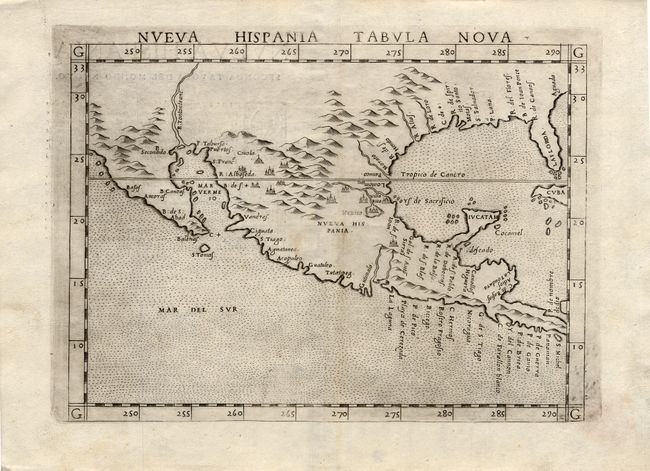
This fine early map of New Spain is an enlarged version of Gastaldi's map of 1548 with the only notable change being the peninsular Yucatan. The legendary seven cities of Civola are noted and Mexico City is shown floating in a large lake. The place names along the upper Gulf Coast reveal the explorations of Pineda, Cabeza de Vaca and Moscosso. The Mississippi makes its appearance as the Rio de Spiritu Santo and the R. Tontonteanc flows in the vicinity of the Colorado River. This is a foundation map in the cartography of the American Southwest. Second state with Italian text on verso.
References: Burden #31; Martin & Martin, plt. 3.
Condition: A+
Dark early impression with some plate ink residue.