Subject: Wyoming - Yellowstone
Period: 1878 (dated)
Publication:
Color: Black & White
Size:
28.5 x 31.7 inches
72.4 x 80.5 cm
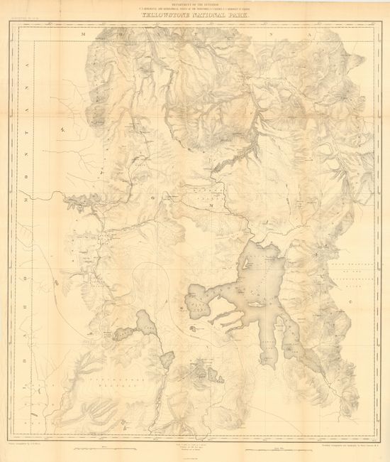
A finely engraved map from the U.S. Geological and Geographical Survey of the Territories while F.V. Hayden was the Geologist in Charge. The map shows the entire park from the Montana state line south to well beyond Yellowstone, Shoshone, Lewis and Heart Lakes, and from the border with Idaho east to the Yellowstone Range and the east fork of the Yellowstone River. Terrific detail of topography with contour intervals at 100 feet, watershed and numerous features, all at a scale of 1 inch = 2 miles. Names the Upper, Shoshone, Gibbon, and Heart Lake Geyser Basins, Mud Geysers, Mammoth Hot Springs, and much more. Primary triangulation by A.D. Wilson and secondary triangulation and topography by Henry Gannett.
References:
Condition: B
Issued folding, now backed with archival tissue. A little very light toning along some folds, else very good.