Catalog Archive
Auction 113, Lot 235

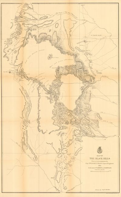
"Map of the Black Hills From a reconnaissance by Capt. William Ludlow Corps. of Engineers and maps of Warren and Raynolds", U.S. War Department

Subject: Dakota Territory

Period: 1874 (dated)

Publication: Report of a Reconnaissance of the Black Hills of Dakota

Color: Black & White

Size:
23.5 x 38 inches
59.7 x 96.5 cm
Download High Resolution Image
(or just click on image to launch the Zoom viewer)

A large map drawn by Sergeant C. Becker and one of three maps resulting from Custer's Expedition. Covers the Black Hills between the Belle Fourche or North Fork of the Cheyenne River to the South Fork of the Cheyenne. Drawn on a scale of 3 miles=1 inch. Topography is nicely developed with portions of Warren's route of 1857 and that of Raynold's in 1859 shown. This expedition led to a discovery of gold and subsequent Gold Rush into the Black Hills.

References: Wheat (TMW) #1249.

Condition: B

Issue folding, now backed with archival tissue. Some light toning on folds.

Estimate: $160 - $200

Sold for: $120

Closed on 12/7/2005

Archived