Subject: Colorado
Period: 1877 (dated)
Publication:
Color: Black & White
Size:
35.3 x 25.4 inches
89.7 x 64.5 cm
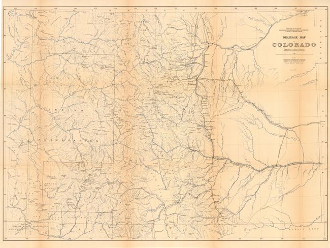
This is a fine examination of the state showing abundant detail of towns, villages, mountain peaks, Indian Reservations, roads, railroad routes, forts, and other early detail. Published by the U.S. Geological and Geographical Survey of the Territories. Hydrology is nicely developed with rivers and creeks shown in blue over-printing; no topographical information is given. The map details a large number of wagon roads, many named, and the route of the Atchison Topeka and Santa Fe, the Colorado Central, the Boulder Valley, and the Durango & Rio Grande (D. & R.G.) railroads, plus several unnamed tracks. The railroad is laid to the town of La Vita but has not yet reached the pass. A terrific map filled with information. Dated March, 1877.
References:
Condition: B
Nice impression with black and blue ink. Issued folding, now pressed and backed with archival tissue. A little toning along some folds, else very good.